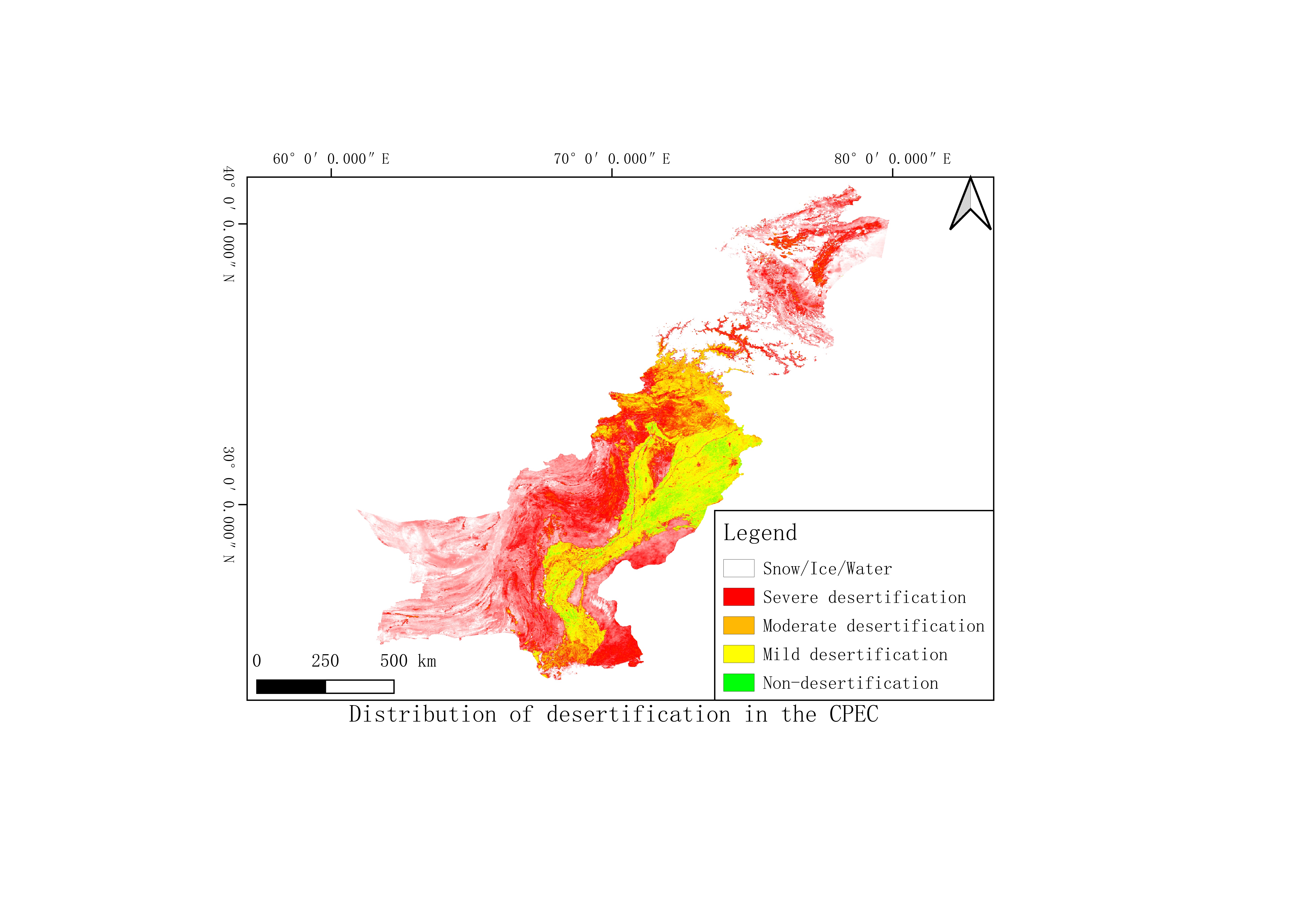
Annual desertification distribution dataset of the China Pakistan Economic Corridor from 2000 to 2017

Desertification difference index (DDI) was used to evaluate the degree of desertification in the Corridor. Based on Normalized Difference Vegetation Index (NDVI) and Albedo, we established the Albedo-NDVI space and a DDI formula through negative correlation between Albedo and NDVI. Based on DDI, we built the dataset of desert distributions along the China-Pakistan Economic Corridor during 2000 – 2017.
Language
zh CN
Format
tif
Creator
Min Yufang, Feng Keting, Kang Jianfang, Ai Minghao
Publisher
University of Chinese Academy of Science
Contributor
Min Yufang, Feng Keting, Kang Jianfang, Ai Minghao
Organization
University of Chinese Academy of Science
Access constraints
Fully shared
Other constraints
No
Date
2000-2017
Date creation
2019-10-06
Date publication
2019-10-06
Source
MODIS、Landsat7
Distanceuom
km
Information evaluation
Relevant information
- Data set for extreme warming process on the East Pamir Plateau at the North End of the China Pakistan Economic Corridor from 1961 to 2017
- China-Pakistan Economic Corridor in 1960-2000 1000m earthquake peak acceleration of ground motion
- China-Pakistan Economic Corridor 1000 meters seismic intensity dataset from 1960 to 2000
- Data set of magnitude, intensity and peak ground motion acceleration of 1000m CPEC earthquakes from 1960 to 2000
- China Pakistan Economic Corridor surface deformation dataset from 2014 to 2018
- China Pakistan Economic Corridor monthly temperature vegetation drought index dataset from 2000 to 2017
- Classification of soil types in the China Pakistan Economic Corridor
